Envisage Test 3
  • Home
  • Site Location and Context
  • Our Proposals
  • Team
  • Contact
  • Online Survey
  • Search
  • Menu Menu

Our Proposals

You are here: Home1 / Our Proposals

Our Proposals

The applicant has worked with a team of technical and environmental consultants to develop a development proposal, that has regard to the following considerations:
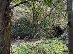
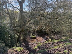
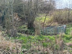
– Highways and Access
– Ecology
– Trees
– Drainage
– Heritage
– Landscape and Visual

Sustainable Access and Transport Matters

The proposed development site is well located to provide much-needed housing, being located adjacent to established residential development, accessed from Uttoxeter Road and within appropriate walking and cycling distances to a range of local facilities.

Walking and Cycling Connectivity

The development proposals will be able to connect into the existing pedestrian footway network on Uttoxeter Road, as well as the Public Footpath, which forms part of the Public Right of Way network along Blackies Lane, which bisects the site. By connecting into these pedestrian routes residents will be able to route along Uttoxeter Road to cross the nearby rail level crossing or walk northwards along Mercer Avenue to connect with the established pedestrian route which runs parallel to the railway line, linked by Kingsland Court and Cranmore Grove, to connect with Pingle Lane. This route then bridges the railway line, providing an attractive route to and from Stone town centre.

Whilst there are no dedicated cycle routes in the vicinity of the site, the surrounding residential streets are suitable for cyclists to use. As part of the emerging sustainable access strategy for the site, the Design Team is looking at ways that the proposed cycle route that is proposed through the site can connect to new cycle facilities on the Uttoxeter Road corridor. We would welcome your thoughts as to whether the development could assist in upgrading existing pedestrian routes along the Lichfield Road corridor to provide shared pedestrian/cycle facilities, or even upgrading the Pingle Lane pedestrian route to a shared facility.

Bus and Rail Access

The nearest bus stop to the site is on Saddler Avenue, and is known as the “Farrier Close Aston Lodge Park” stop. This will be accessible via Blackies Lane from the site, and is a c.400m walk distance from the centre of the site. This service runs on an hourly frequency during the day, and there are opportunities for the development, through discussions with the Council and Bus Operator to extend the timings of the service during the week and also at weekends. A new bus stop could also be provided on Ashton Lodge Parkway, easily accessible from the development via Uttoxeter Road and Blackies Lane, and funded by the development.

Stone rail station is a c.3km walk and cycle from the site, a c.40 minute walk or c.10 minute cycle ride. With each residential property having secure, covered cycle parking facilities residents will have facilities to store their bicycle at their home, making it easy for them to make shorter trips by cycle to the town centre, rail station and other local destinations.

Development Access Arrangements

The development proposals will have a new vehicular access onto Uttoxeter Road, in a similar design to the junction that serves Oakleigh Court and Mount Pleasant Close. The final access design will accommodate all vehicular traffic generated by the site, as well as refuse and emergency vehicle access. The design will also provide appropriate visibility splays that relate to recorded vehicle speeds on Uttoxeter Road.

The Design Team are aware through recent speed surveys on this route that a proportion of traffic is travelling at speeds higher than the 30mph speed limit. As part of the development access design measures to slow traffic to accord with the existing speed limit will be incorporated, to benefit all highway users.

An assessment of the additional traffic associated with the c.130 residential scheme is predicted to generate an additional c.70 vehicle movements onto Uttoxeter Road in the AM and PM peak periods. This traffic will distribute across the local highway network, and as part of the future planning application a full Transport Assessment will be prepared, assessing the impact (in traffic and transport terms) of the development on the surrounding area. This will include assessing the impact of additional traffic movements at the nearby level crossing on Uttoxeter Road. Our final technical scope of work will be discussed and agreed with Staffordshire Council’s Highways Officers before any planning submission.

Detailed Design Aspects

The scheme design will provide cycle and vehicular parking across the site that meets the Council’s adopted parking standards. Cycle parking will be provided either through oversized garages or through secure, covered storage facilities on the curtilage of each property. Each property will have an Electric Vehicle (EV) charging point on their driveway or allocated parking space. To encourage sustainable travel to and from the site a site-wide Travel Plan will be prepared and implemented at the time that the site is first occupied.

Ecology

E3P have been appointed to undertake a full Ecological Appraisal of the site to inform the layout. An intial walkover survery has been conducted which identified the following:

Habitat

Artificial unvegetated; unsealed surface, modified grassland, mixed scrub, woodland, trees, native hedgerows, and watercourses

As much of this varied habitat will be retained within the final proposals as possible.

Species

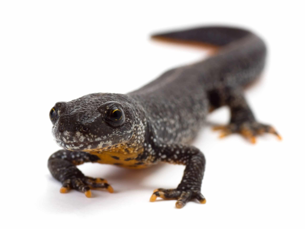
Amphibians – The habitat could be suitable for Great Crested New and common amphibians and further survey work will be undertaken.

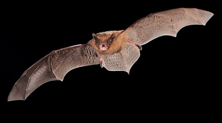
Bats – the site offers foranging and commuting potential due to hedgerows, watercourses, scrub and trees -as such bat surveys will be undertaken and a lighting mitigaiton will be provided as part of the proposals.

Badger – no badger setts have been identified  alhtough foraging and sett building opportunties are present on site and so precautionary working methods for badger are recommended

Other mammals – foraging, shelter and hibernation opportunities for hedgehogs within the on-site grassland, scrub, woodland are recommended . The grassland comprise good quality habitat for brown hare, which may be present on site.

Otter and water vole – Water courses are shallow and culverted downstream – Otter and water vole discounted from further assessment.

Birds– Common bird nesting opportunities within the scrub, woodland, hedgerows, and trees exist and there is the potential for ground-nesting birds within the arable field.

Reptiles –the site is not anticipated to support large numbers of reptiles as the site predominantly comprised arable land but the watercourse, longer sward grassland, scrub, and hedgerows may provide some shelter for reptiles.

Invertebrates – Common invertebrates are likely to be present within the watercourses, grassland, scrub, and hedgerows.

The proposals will include the mandatory 10% gains in Biodiversity either on site or off-site.

Trees

A full survey of all trees and hedgerows on the site has been undertaken. The scheme will retain as many trees as possible and provide mitigation for those lost. As is evident from the plan below most trees are located aorund the edges of the site and within/around the watercourse running through the middle of the site.

Drainage

A drainage strategy is being developed by RAcE. It will include Sustainable urban Drainage Systems (SuDs).

The current flood risk maps for planning however confirm that most of the site is within Flood Zone 1(with the lowest risk of flooding but that parts of the northern portion of the site is located within Flood Zones 2 and 3 around the brook.

In terms of surface water the current flood maps indicate that site does not feature surface water and is not forecast to increase by such an amount to cause issues now within the 1,000 year event. See extract from the annual likelihood of flooding 1: 1000 map below.


The proposals will be designed to ensure that there are no flood risks to future occupiers and that flooding is not made worse off site as a result of the proposals

The watercourse running through the middle of the site will be retained and its banks repaired. There wil be appropriate stand off from the banks edges to account for heavy rainfall.

Heritage

A full heritage assessment has been undertaken to understand any historical constraints. As is event from the plans below there are no heritage assets above or beneath the ground on site which will impede development.

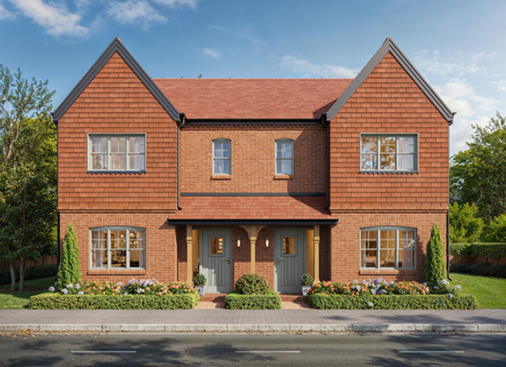
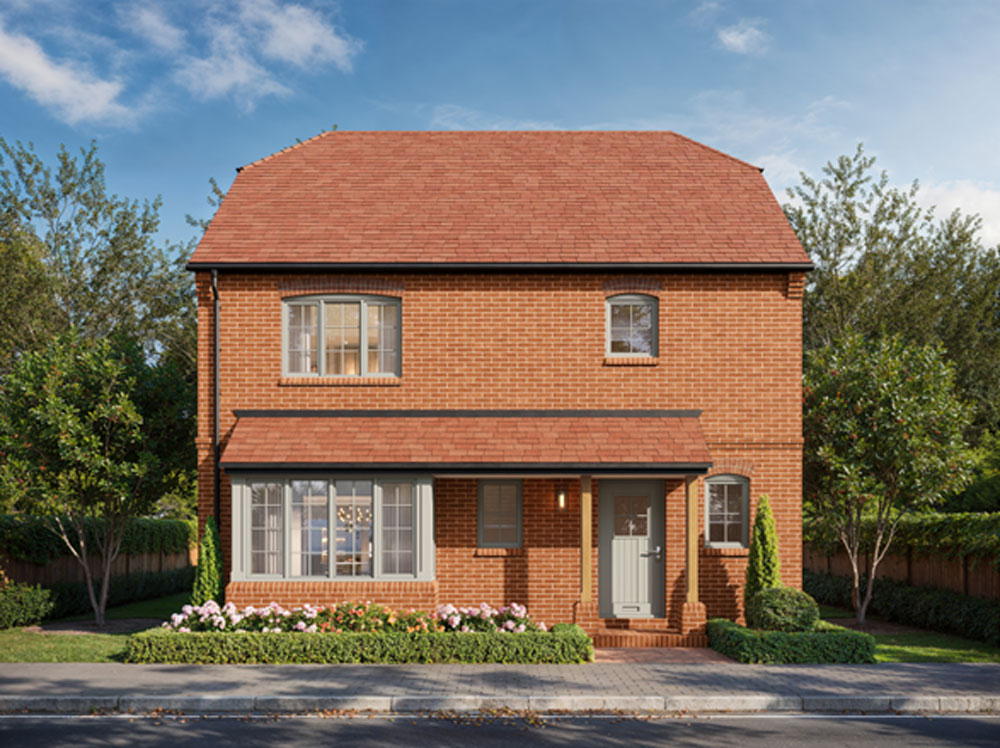
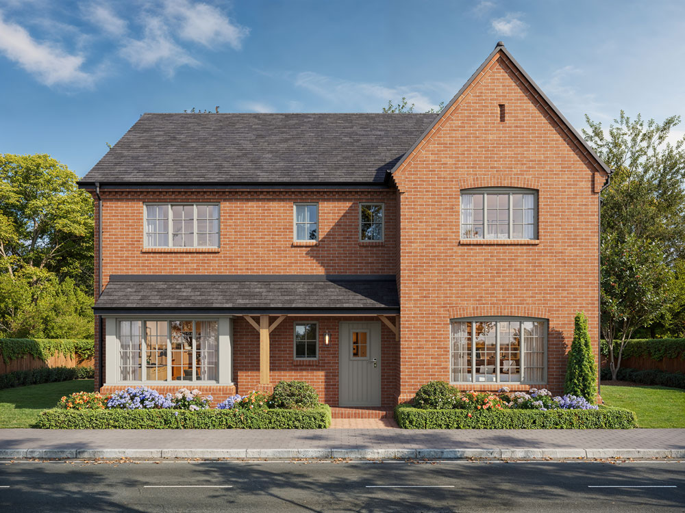
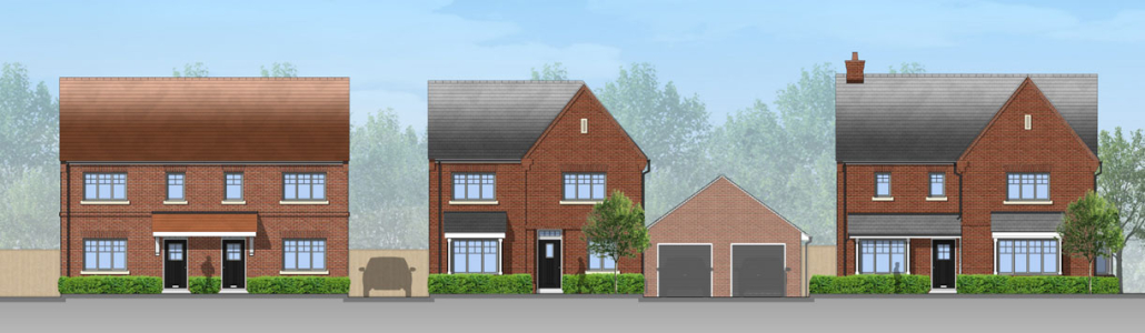
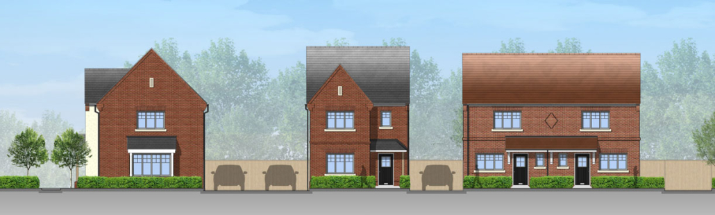
Crest Nicholson House Types


© 2023 Cerda Planning - Privacy Policy | Website design - - Envisage Marketing
  • Privacy Policy
Scroll to top

This site uses cookies. By continuing to browse the site, you are agreeing to our use of cookies.

Accept settingsHide notification onlySettings

Cookie and Privacy Settings


How we use cookies

We may request cookies to be set on your device. We use cookies to let us know when you visit our websites, how you interact with us, to enrich your user experience, and to customize your relationship with our website.

Click on the different category headings to find out more. You can also change some of your preferences. Note that blocking some types of cookies may impact your experience on our websites and the services we are able to offer.

Essential Website Cookies

These cookies are strictly necessary to provide you with services available through our website and to use some of its features.

Because these cookies are strictly necessary to deliver the website, refuseing them will have impact how our site functions. You always can block or delete cookies by changing your browser settings and force blocking all cookies on this website. But this will always prompt you to accept/refuse cookies when revisiting our site.

We fully respect if you want to refuse cookies but to avoid asking you again and again kindly allow us to store a cookie for that. You are free to opt out any time or opt in for other cookies to get a better experience. If you refuse cookies we will remove all set cookies in our domain.

We provide you with a list of stored cookies on your computer in our domain so you can check what we stored. Due to security reasons we are not able to show or modify cookies from other domains. You can check these in your browser security settings.

Other external services

We also use different external services like Google Webfonts, Google Maps, and external Video providers. Since these providers may collect personal data like your IP address we allow you to block them here. Please be aware that this might heavily reduce the functionality and appearance of our site. Changes will take effect once you reload the page.

Google Webfont Settings:

Google Map Settings:

Google reCaptcha Settings:

Vimeo and Youtube video embeds:

Accept settingsHide notification only